Hong Kong may only be about half the size of Tokyo, but within this relatively small area, you’ll find a surprising number of hiking trails. With routes ranging from easy to challenging, it’s a place where beginners and experienced hikers alike can enjoy the outdoors.
Thanks to its warm climate throughout the year, hiking is possible almost anytime—except during the peak of summer heat or typhoon season—and it’s a popular hobby for many locals.
When I was living in Hong Kong, I often spent my weekends hiking. In most cases, I could reach the trailhead within 30 minutes, so there was no need to wake up especially early. That ease of access made it something I could plan casually.
In this article, I’ll introduce some of my favorite hiking trails, grouped by difficulty level.
Hopefully this gives you some ideas to try for yourself.
Quick Picks
- Best easy walk: Victoria Peak Loop
- Best beginner hike: Dragon’s Back
- Best city view: Lion Rock
- Best nature escape: Sharp Peak & Tai Wan
- Most challenging: Pat Sin Leng
Overview of Trails
| Trail | Level | Distance | Time | Best for |
|---|---|---|---|---|
| Victoria Peak Loop | ★☆☆☆☆ | 3.5 km | ~1 hr | Casual walk, city views |
| Dragon’s Back | ★☆☆☆☆ | 7.2 km | ~2 hrs | First hike, scenic ridge |
| Lion Rock | ★★☆☆☆ | 3.9 km | ~2 hrs | Iconic skyline view |
| Violet Hill & Twin Peaks | ★★★☆☆ | 4.7 km | ~2.5 hrs | Stairs workout, challenge |
| Sharp Peak & Tai Wan | ★★★☆☆ | 15.8 km | ~6 hrs | Remote nature, beaches |
| Sunset Peak & Lantau Peak | ★★★★☆ | 13.7 km | ~6–7 hrs | Mountain views, sunrise/sunset |
| Cloudy Hill & Pat Sin Leng | ★★★★☆ | 13.8 km | ~5–6 hrs | Endurance, advanced hikers |
Victoria Peak Loop (太平山頂)
Victoria Peak—often simply called “The Peak”—is one of the most famous viewpoints in Hong Kong. If you’re heading up there anyway, why not take a loop walk around it?
The Peak Tram is the most convenient way up, but you can also take a bus or taxi. If you’re looking for a bit more of a workout, you can even hike up from Central.
The full loop is about 3.5km and takes around an hour. It’s mostly flat, so it feels more like a relaxing walk than a hike.
While the harbor view is the classic highlight, you can also enjoy views on the opposite side of the island, which offers a slightly different perspective.
My recommendation is to go in the evening—walking with the city lights below you is a completely different experience.

Dragon’s Back (龍脊)
Level ★☆☆☆☆
Distance: 7.2km
Elevation gain: 221m
Estimated time: 2h 15m
Dragon’s Back is often one of the first hikes beginners try in Hong Kong. As the name suggests, the trail follows a ridge that looks like the spine of a dragon, with relatively gentle slopes.
To get there, take the MTR to Shau Kei Wan, then transfer to bus 9 and get off at Shek O Road.
The trailhead is right near the bus stop, so it’s easy to find.

After about 1.5km of gradual uphill, you’ll reach Shek O Peak.


The view from here is one of the highlights.

From there, it’s mostly downhill to Big Wave Bay.
It’s a great place to relax after hiking, though it can get busy on nice days.

Lion Rock (獅子山)
Level ★★☆☆☆
Distance: 3.9km
Elevation gain: 394m
Estimated time: 1.5–2 hours
Another well-known spot is Lion Rock.
There are some steeper uphill sections, so it’s slightly more challenging than beginner routes. However, since the total distance is short and no technical skills are required, it’s still very manageable.
From the top, you’ll get a sweeping view of Kowloon’s skyline, Victoria Harbour, and Hong Kong Island beyond.

To get there, take the MTR to Lok Fu Station and walk about 20 minutes.

It takes less than an hour to reach the summit, though some parts are steep.

It’s also a popular night hike for its city views.

Violet Hill (紫羅蘭山) & Twin Peaks (孖崗山)
Level ★★★☆☆
Distance: 4.7km
Elevation gain: 391m
Estimated time: 2h 30m
One of the more challenging hikes on Hong Kong Island is the combination of Violet Hill and Twin Peaks.
Hong Kong trails are known for their stairs, and this one is no exception—there are said to be over 1,200 steps in total, making it both physically and mentally demanding.
You can take a bus close to the trailhead. From Central, bus number 6 will take you there directly.
Get off at Wong Nai Chung Reservoir Park, then walk about 10 minutes uphill along Tai Tam Reservoir Road to reach the entrance.

There are some flatter sections, but overall it’s a steady climb. After about 1km, you’ll reach the summit of Violet Hill.

From there, descend for about 1.5km before heading up again toward Twin Peaks.
This section is especially tough, with endless stone steps—but the sense of accomplishment at the top makes it worth it.


The descent from the second peak offers beautiful views over the Stanley peninsula.

At the end, you’ll reach a road right in front of a bus stop on Stanley Gap Road, making it easy to head back into the city.

I recommend taking bus number 6 and stopping at Repulse Bay along the way.
After a sweaty hike, a swim in the ocean and some time relaxing on the beach is the perfect way to reset.

Sharp Peak (蚺蛇尖) & Tai Wan (大灣)
Level ★★★☆☆
Distance: 15.8km
Elevation gain: 781m
Estimated time: 5h 30m – 7h
Sai Kung is one of the most nature-rich areas in Hong Kong. There are many great trails here, but this route is one of my personal favorites.
It connects Sharp Peak—often considered a must-visit for hiking enthusiasts—with Tai Wan Beach, which is sometimes described as one of the most beautiful beaches in Hong Kong.

To get to the trailhead, first head to Sai Kung Bus Terminal. From there, transfer to bus 94 or 96R and get off at Pak Tam Au.
The first ~2.5km is relatively flat, passing through a small bay area called Chek Keng.


After climbing for about 1.5km, you’ll reach a junction—this is where you turn toward Sharp Peak.


As the name suggests, the peak is quite sharp and steep in sections—but on a clear day, the views are incredible.

From here, it’s mostly downhill toward Tai Wan.
Compared to beaches on Hong Kong Island, this area is harder to access, so it’s usually much quieter—and the water is incredibly clear. It’s one of my favorite spots.
You’ll also often see cows grazing freely around here.

About 1km further, you’ll reach a village called Ham Tin, where you’ll find small restaurants, showers, and even speedboats back to Sai Kung (reservation required).
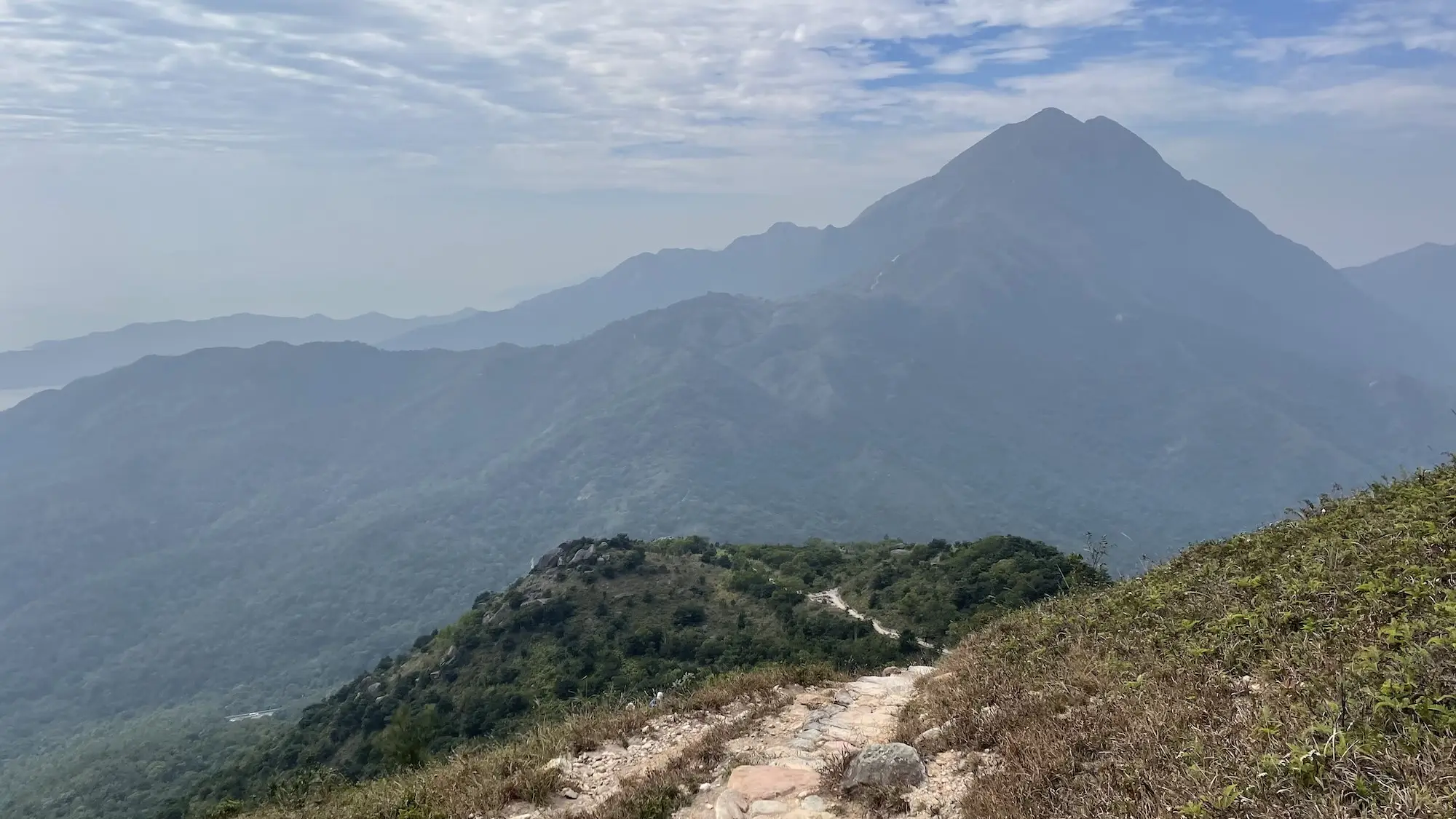
Sunset Peak (大東山) & Lantau Peak (鳳凰山)
Level ★★★★☆
Distance: 13.7km
Elevation gain: 1,429m
Estimated time: 6h 39m
On Lantau Island—home to Hong Kong’s airport—you’ll find two of the most well-known hiking spots: Sunset Peak and Lantau Peak.
At 869m and 934m respectively (with Lantau Peak being the second-highest point in Hong Kong), both require longer climbs than most trails, making this a more physically demanding route.
The route starts from Mui Wo, which you can easily reach by ferry from Central.
After getting off the ferry, walk along South Lantau Road for about 30 minutes until you reach the trailhead.

From there, it’s a steady 4.5km climb up to Sunset Peak.
On a clear day, the 360-degree views from the summit are incredible.


After descending about 2km, you’ll reach Pak Kung Au, where you can catch a bus to Tung Chung if needed.

From there, it’s another 3km climb up to Lantau Peak.


The views from the top are just as rewarding.

From Lantau Peak, descend about 2km to Ngong Ping, where you’ll find the Big Buddha.


From Ngong Ping, it’s easy to take a bus back to Tung Chung or Mui Wo.
Cloudy Hill (九龍坑山) & Pat Sin Leng (八仙嶺)
Level ★★★★☆
Distance: 13.8km
Elevation gain: 833m
Estimated time: 5h 17m
This trail is located in the northern New Territories, closer to mainland China.
The name “Pat Sin Leng” means “Eight Immortals Ridge,” referring to the eight peaks along the route.
Start from Tai Wo Station and follow the path that connects to the Wilson Trail toward Cloudy Hill.
After about 3km of climbing, you’ll reach the summit.

From there, descend for about 4km before entering the Pat Sin Leng section.


Then comes another 5km climb to reach the first peak.

From here, you’ll repeat a series of climbs and descents across the remaining peaks. It can be mentally tough, but the sense of accomplishment is unique.

This area is also popular for trail running events, making it a great challenge for more experienced hikers.
Summary
Hong Kong isn’t just about shopping and food—it’s also a place where you can enjoy outdoor activities like hiking.
If you’re just getting started, why not begin with a casual walk around Victoria Peak?
And if you’re ready for more challenging trails, check out these long trails too!

Leave a Reply